Big Lagoon: depth, boat ramps and water quality
Boat: 3 ramps and launches on file for this water.
Start here: Launch at Big Lagoon State Park - Boat Ramp, 2 lanes, concrete.
The estuary
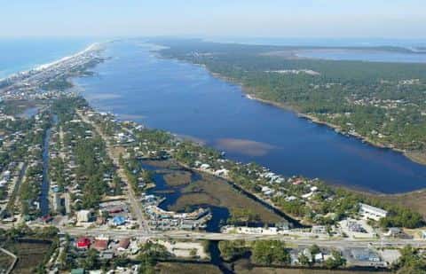
Big Lagoon covers 3,117 acres in Florida, across Escambia County. It is an estuary: the deepest point measured is 41.8 feet (12.7 m). Our records hold 17 species for this water.
Depth: down to 41.8 ft at the deepest measured point
Deepest measured point: 41.8 ft (12.7 m). We hold 1 depth contour for this water, drawn from 113,696 soundings.
Water and conditions
Water clarity runs 2–13 feet on our readings, averaging 8.4 feet, from 91 readings. Our water temperature readings average 76°F; they do not cover the whole year, so this is not a yearly average. The coldest single reading we hold is 59°F and the warmest is 91°F; the warmest monthly average is 86°F. pH averages 7.9. These readings span 2016–2024.
3 ramps and launches on this water
On this water we hold 2 trailer ramps, 1 hand launch and 1 fishing pier.
- Big Lagoon State Park - Boat Ramp — 2 lanes, concrete, parking for 40 trailers (paved), paid, daylight hours, flush restrooms, dock, restrooms. Pensacola, Florida Department of Environmental Protection. 12301 Gulf Beach Highway, Pensacola 32507 · website floridastateparks.org/parks-and-trails/big-lagoon-state-park
- Gulf Islands National Seashore - Perdido Key - Johnson Beach (Very Small Boats Only) — 1 lane, gravel, paid, daylight hours, flush restrooms. Pensacola, United States National Park Service. 13242 Johnson Beach Road, Pensacola 32507 · website nps.gov/guis/planyourvisit/perdido-key-area.htm
Car-top and kayak launches — no trailer
- Big Lagoon State Park - Kayak Launch — hand launch, sand, parking for 48 cars, paid, daylight hours, flush restrooms. Pensacola, Florida Department of Environmental Protection. 12301 Gulf Beach Highway (292A), Pensacola 32507 · website floridastateparks.org/parks-and-trails/big-lagoon-state-park
Fishing piers
- NAS Pensacola - Shermans Cove — no fee, open 6am–6pm. On Sherman Cove, Nas Pensacola, U. S. Navy. 3541 Radford Blvd., Bldg. 4151, Nas Pensacola 32508
3 of the 4 places listed have both a fee and opening hours on file: a blank means we hold no such field, not that it is free or always open, and this list may not be complete.
What is hard here
Clarity swings from 2 to 13 feet between our readings — the water you meet is not the water someone photographed. Summer water sits at 86°F: heat and afternoon lightning are the real risks, not the fishing.
Where this data comes from
- NOAA Digital Coast — NOAA Digital Coast bathymetric lidar: class A, a survey of the bottom, 1983.
- USACE eHydro — USACE eHydro channel surveys: class A, a survey of the bottom.
- NOAA NOS Hydro — NOAA NOS hydrographic survey archive: class A, a survey of the bottom.
- NOAA BlueTopo: class A, a survey of the bottom.
- NOAA National Bathymetric Source (S-102 ed3.0.0) — NOAA S-102 bathymetric surfaces: contours: class A, a survey of the bottom.
- NOAA ENC — NOAA Electronic Navigational Charts: soundings: class A, a survey of the bottom.
- NOAA ENC — NOAA Electronic Navigational Charts: depth contours: class A, a survey of the bottom.